Harnett County Resources
- View All:
- Biographies
- Monuments
- locations
ANCHOR (A North Carolina History Online Resource) is now its own website!
Copyright Notice: This article is from the Encyclopedia of North Carolina edited by William S. Powell. Copyright © 2006 by the University of North Carolina Press. Used by permission of the publisher. For personal use and not for further distribution. Please submit permission requests for other use directly to the publisher.
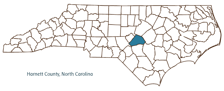
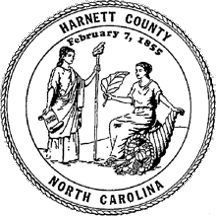
Harnett County, located in North Carolina's Coastal Plain region, was formed from Cumberland County in 1855. It is named for Cornelius Harnett, Revolutionary War patriot and delegate to the Continental Congress. The county's communities include Dunn, Coats, Angier, Erwin, Buies Creek, Bunnlevel, and Johnsonville, as well as the county seat, Lillington, incorporated in 1859.
The region was originally inhabited by Tuscarora and Saura (Cheraw) Indians. Among the earliest European settlers in Harnett County were Scottish immigrants, many of whom left their homeland after the 1745 Jacobite Rebellion. Forced to vow that they would never again fight the British, many Scots who adopted a neutral stance during the Revolutionary War were executed as traitors by American Patriots. Harnett County nevertheless maintained a large Scottish population-Gaelic was spoken in parts of the county well into the late nineteenth century-and even today many families in the area can trace their ancestry back to those early Scots.
Harnett County was the site of one of the last battles of the Civil War, a confrontation between Gens. William T. Sherman and William J. Hardee at Averasboro, near Erwin, on 15-17 Mar. 1865. Historical markers denote major events and a museum interprets the battle.
Harnett County's principal towns developed into important local trading and commercial centers after urban development began in the 1880s, though by the early twenty-first century the county had only recently begun to promote industrial expansion. The primary source of income remained agriculture, which either employed or indirectly sustained a majority of the county's population.
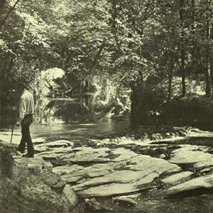
Important agricultural products include tobacco, cotton, sweet potatoes, soybeans, wheat, swine, and beef and dairy cattle. Manufactures include textiles, building materials, furniture, mobile homes, and athletic equipment. Raven Rock State Park, established in 1970, is one of the county's principal natural attractions. In 2004 the population of Harnett County was estimated at 99,600.
For an annotated history of the county's formation, with the laws affecting the county, boundary lines and changes, and other origin information, visit these references in The Formation of the North Carolina Counties (Corbitt, 2000), available online at North Carolina Digital Collections (note, there may be additional items of interest for the county not listed here):
County formation history: https://digital.ncdcr.gov/Documents/Detail/the-formation-of-the-north-ca...
Index entry for the county: https://digital.ncdcr.gov/Documents/Detail/the-formation-of-the-north-ca...
References:
Hairr, John. Harnett County: A History. Mount Pleasant: Arcadia Publishing, 2002.
Additional resources:
Corbitt, David Leroy. The Formation of the North Carolina Counties, 1663-1943. Raleigh: Division of Archives and History, North Carolina Department of Cultural Resources, 1987. https://digital.ncdcr.gov/Documents/Detail/the-formation-of-the-north-carolina-counties-1663-1943/3692099?item=4553233 (accessed June 20, 2017).
Harnett County Government. "Harnett County, North Carolina." http://www.harnett.org/ (accessed February 13, 2019).
Angier Chamber of Commerce. "The Angier Chamber of Commerce." https://www.angierchamber.org/ (accessed February 13, 2019).
Dunn Area Chamber of Commerce. "Dunn, North Carolina." https://dunnchamber.com/ (accessed February 13, 2019).
Erwin Chamber of Commerce. "Erwin, North Carolina." https://erwinchamber.org/ (accessed February 13, 2019).
Lillington Chamber of Commerce. "Lillington Area Chamber of Commerce." https://lillingtonchamber.org/ (accessed February 13, 2019).
DigitalNC. "Harnett County." North Carolina Digital Heritage Center. https://www.digitalnc.org/counties/harnett-county/ (accessed February 13, 2019).
North Carolina Digital Collections. "Explore by ... [place, time period, format]." North Carolina Department of Natural and Cultural Resources. https://digital.ncdcr.gov (accessed February 13, 2019).
Image credits:
Rudersdorf, Amy. "NC County Maps." Raleigh: Government & Heritage Library, Library of North Carolina, 2010.
Vocci, Robert Blair. "Harnett County." NCpedia. Library of NC. 2006.
HARNETT COUNTY GOVERNMENT:
http://www.harnett.org/
COUNTY SEAT:Lillington
FORMED: 1855
FORMED FROM: Cumberland
LAND AREA: 594.99 square miles
2020 POPULATION ESTIMATE: 133,568
White: 71.3%
Black/African American: 21.9%
American Indian: 1.7%
Asian: 1.3%
Pacific Islander: 0.2%
Two or more races: 3.5%
Hispanic/Latino: 13.4% (of any race)
From State & County QuickFacts, US Census Bureau, 2020.
CONGRESSIONAL DISTRICT: 2ND
BIOGRAPHIES FOR![]()
Harnett County
 WILDLIFE PROFILES FOR
Coastal Plain
GEOGRAPHIC INFORMATION
REGION: Coastal Plain
RIVER BASIN: Cape Fear, Map
NEIGHBORING COUNTIES: Chatham, Cumberland, Johnston, Lee, Moore, Sampson, Wake