Wake County Resources
- View All:
- Biographies
- Monuments
- locations
ANCHOR (A North Carolina History Online Resource) is now its own website!
We have rescheduled our maintenance on NCpedia to Friday, May 22, beginning at 3 pm. You may experience access issues over the weekend (May 23 and 24). We apologize for the inconvenience.
Copyright Notice: This article is from the Encyclopedia of North Carolina edited by William S. Powell. Copyright © 2006 by the University of North Carolina Press. Used by permission of the publisher. For personal use and not for further distribution. Please submit permission requests for other use directly to the publisher.
See also: Joel Lane House; Meredith College; North Carolina Museum of Art; North Carolina Museum of History; North Carolina State University; Raleigh; Research Triangle Park; Saint Augustine's College; State Capitol.
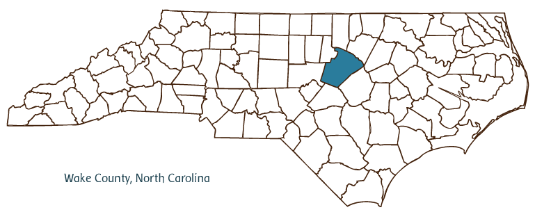
Wake County, located in the Piedmont region of North Carolina, was formed in 1771 from Johnston, Cumberland, and Orange Counties and named for Margaret Wake Tryon, the wife of royal governor William Tryon. Early inhabitants of the area included the Sissipahaw and Occaneechi Indians; English and Scotch-Irish settlers later populated the region. Raleigh was established as the county seat in 1771 under the name Wake County Courthouse; the name was changed to Raleigh, in honor of Sir Walter Raleigh, when the city became the capital of North Carolina in 1792. Other Wake County cities and towns, all within what is fast becoming a solid ring of urban and suburban development surrounding Raleigh, include Cary, Garner, Fuquay-Varina, Holly Springs, Apex, Morrisville, Wake Forest, Zebulon, Wendell, and Knightdale. Notable bodies of water within the county include the Neuse River, Wake Forest Reservoir, Falls, Wheeler, Crabtree, and Bass Lakes, and Swift, Sycamore, and Hominy Creeks.
Wake County is one of North Carolina's most urbanized counties, with an estimated population of nearly 724,000 in 2004. It is dominated by the state government and its ancillary institutions, multiple large businesses and corporations located in Research Triangle Park (which straddles the line between Wake and Durham Counties) and other locales around Raleigh, and its outstanding colleges and universities-North Carolina State University (1887), Peace College (1857), Shaw University (1865), Saint Augustine's College (1867), and Meredith College (1891). Important cultural and historical landmarks and institutions abound in Raleigh and vicinity and include the State Capitol (1833-40); the Governor's Mansion (1891); the State Legislative Building (1961); the Joel Lane House (1760s), the oldest house in Raleigh; Mordecai Historic Park (1785); and the North Carolina State Fairgrounds. Important institutions and attractions include the North Carolina Museum of History, the North Carolina Museum of Art, the North Carolina Museum of Natural Sciences, Raleigh Ensemble Players, Exploris, Raleigh Little Theatre and Rose Garden, the North Carolina Symphony Orchestra, North Carolina State University Crafts Center Gallery, the North Carolina Literary and Historical Association, the North Carolina State Archives, and the Wendell Post Office Museum. William B. Umstead State Park is one of Wake County's many recreational areas. The county hosts popular festivals and annual events such as the North Carolina State Fair, Saint Patrick's Day Parade, the state Special Olympics Summer Games, the International Festival, Executive Mansion Christmas, the Today and Yesteryear Festival, and Rolesville Fireman's Day.
Wake County farmers continue to produce agricultural goods such as nursery and landscape plants, vegetables, and tobacco. Manufactured products include high-tech items such as digital electronics, telecommunications equipment, measuring devices, and pharmaceuticals. Also produced are electric switch gears, flooring, and refrigeration equipment. Minerals such as soapstone, corundum, beryl, graphite, kyanite, pyrite, and magnesite are mined in the county.
For an annotated history of the county's formation, with the laws affecting the county, boundary lines and changes, and other origin information, visit these references in The Formation of the North Carolina Counties (Corbitt, 2000), available online at North Carolina Digital Collections (note, there may be additional items of interest for the county not listed here):
County formation history: https://digital.ncdcr.gov/Documents/Detail/the-formation-of-the-north-carolina-counties-1663-1943/3692099?item=4553476
Index entry for the county: https://digital.ncdcr.gov/Documents/Detail/the-formation-of-the-north-carolina-counties-1663-1943/3692099?item=4553611
Peace College became William Peace University in 2011.
The North Carolina State Archives officially changed their name to the State Archives of North Carolina in 2012.
References:
Elizabeth Reid Murray, Wake: Capital County of North Carolina (1983).
Additional resources:
Corbitt, David Leroy. 2000. The formation of the North Carolina counties, 1663-1943. https://digital.ncdcr.gov/Documents/Detail/the-formation-of-the-north-carolina-counties-1663-1943/3692099?item=4553233 (accessed June 20, 2017).
Wake County Government: https://www.wake.gov/
Greater Raleigh Chamber of Commerce: https://www.raleighchamber.org/
DigitalNC, Wake County: https://www.digitalnc.org/counties/wake-county/
North Carolina Digital Collections (explore by place, time period, format): https://digital.ncdcr.gov
Image credits:
Rudersdorf, Amy. 2010. "NC County Maps." Government & Heritage Library, State Library of North Carolina.
Powell, William S. "Wake County." NCpedia. Library of NC. 2006.

WAKE COUNTY GOVERNMENT:
www.wakegov.com
COUNTY SEAT: Raleigh
FORMED: 1771
FORMED FROM: Johnston, Cumberland, Orange
LAND AREA: 835.22 square miles
2020 POPULATION ESTIMATE: 1,129,410
White: 67.9%
Black/African American: 21.0%
American Indian: 0.8%
Asian: 7.7%
Pacific Islander: 0.1%
Two or more races: 2.6%
Hispanic/Latino: 10.4% (of any race)
From State & County QuickFacts, US Census Bureau, 2020.
CONGRESSIONAL DISTRICT: 2ND, 4TH
BIOGRAPHIES FOR![]()
Wake County
 WILDLIFE PROFILES FOR
Piedmont region
GEOGRAPHIC INFORMATION
REGION: Piedmont
RIVER BASIN: Neuse, Cape Fear, Map
NEIGHBORING COUNTIES: Chatham, Durham, Franklin, Granville, Harnett, Johnston