Perquimans County Resources
- View All:
- Biographies
- Monuments
- locations
ANCHOR (A North Carolina History Online Resource) is now its own website!
Copyright Notice: This article is from the Encyclopedia of North Carolina edited by William S. Powell. Copyright © 2006 by the University of North Carolina Press. Used by permission of the publisher. For personal use and not for further distribution. Please submit permission requests for other use directly to the publisher.
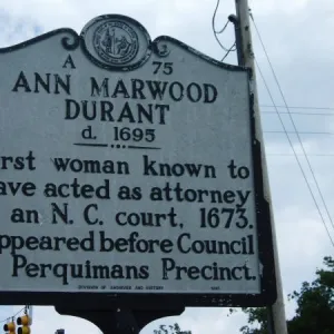
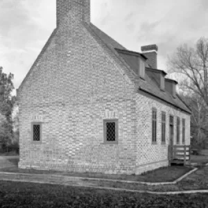
See also: Newbold-White House.
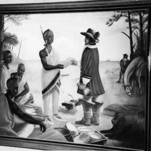
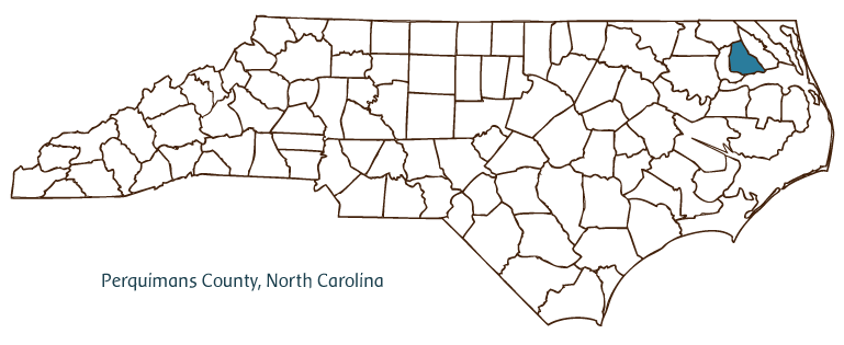
Perquimans County, located in the Coastal Plain region of North Carolina, was formed in 1679 and originally called Berkeley Precinct of Albemarle County; it was later renamed for the Perquimans Indians of the area. It is partially bordered by the Albemarle Sound. The Weapemeoc as well as Perquimans Indians were early inhabitants of the county, followed by English and Welsh settlers. Hertford, the county seat, was incorporated in 1758 and named after Hertford, England; the town was originally called Phelps Point after a local landowner named Jonathon Phelps. Other communities in Perquimans County include Winfall, Belvidere, Durants Neck, Chapanoke, and Snug Harbor. Notable physical features, in addition to the Albemarle Sound, include the Perquimans, Little, and Yeopim Rivers, Harvey and Grassy Points, and Godwin and Sutton Creeks.
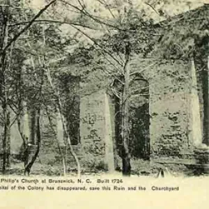
Among Perquimans County's landmarks and historic sites are the brick Newbold-White House (ca. 1730), the Alfred Moore House (ca. 1825), the Thomas Nixon Plantation (1848), and Piney Woods Friends Meetinghouse (1854). The county hosts several popular festivals and annual events, including the Perquimans County Indian Summer Festival, the Hearth and Harvest Festival, and the Spring Fling and Old-Timers Game.
Perquimans County, with 100 miles of shoreline, is a haven for boaters, fishers, and hunters. The county has more than 65,000 acres of active farmland producing soybeans, corn, peanuts, cotton, vegetables, poultry, swine, and beef cattle. The county's primary manufactured product is apparel. The estimated population of Perquimans County in 2004 was slightly less than 12,000.
For a listing of townships in Perquimans County, visit the NC Gazetteer entry (print book published by UNC Press) in NCpedia.
For an annotated history of the county's formation, with the laws affecting the county, boundary lines and changes, and other origin information, visit these references in The Formation of the North Carolina Counties (Corbitt, 2000), available online at North Carolina Digital Collections (note, there may be additional items of interest for the county not listed here):
County formation history: https://digital.ncdcr.gov/Documents/Detail/the-formation-of-the-north-ca...
Index entry for the county: https://digital.ncdcr.gov/Documents/Detail/the-formation-of-the-north-ca...
Additional resources:
Corbitt, David Leroy. 2000. The formation of the North Carolina counties, 1663-1943. https://digital.ncdcr.gov/Documents/Detail/the-formation-of-the-north-carolina-counties-1663-1943/3692099?item=4553233 (accessed June 20, 2017).
Perquimans County Government: http://www.co.perquimans.nc.us/
Perquimans County Chamber of Commerce: https://www.visitperquimans.com/
DigitalNC, Perquimans County: https://www.digitalnc.org/counties/perquimans-county/
North Carolina Digital Collections (explore by place, time period, format): https://digital.ncdcr.gov
Image credits:
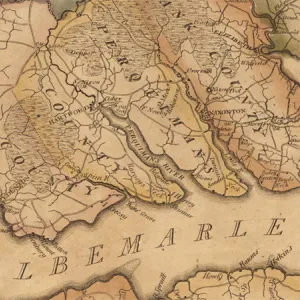
Rudersdorf, Amy. 2010. "NC County Maps." Government & Heritage Library, Library of North Carolina.
Powell, William S. "Perquimans County." NCpedia. Library of NC. 2006.

PERQUIMANS COUNTY GOVERNMENT:
www.co.perquimans.nc.us
COUNTY SEAT: Hertford
FORMED: 1668
FORMED FROM: Albemarle
LAND AREA: 247.09 square miles
2020 POPULATION ESTIMATE: 13,005
White: 74.6%
Black/African American: 22.7%
American Indian: 0.5%
Asian: 0.5%
Pacific Islander: <0.1%
Two or more races: 1.7%
Hispanic/Latino: 2.7% (of any race)
From State & County QuickFacts, US Census Bureau, 2020.
CONGRESSIONAL DISTRICT: 3RD
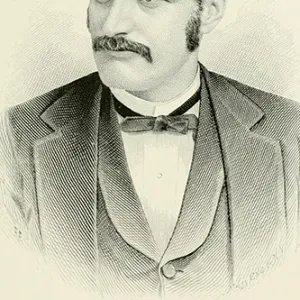
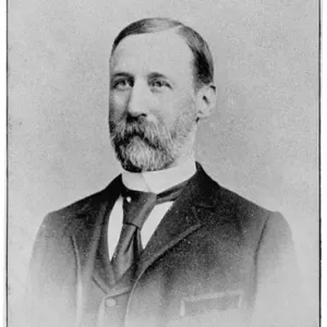
BIOGRAPHIES FOR![]()
Perquimans County
 WILDLIFE PROFILES FOR
Coastal Plain
GEOGRAPHIC INFORMATION
REGION: Coastal Plain
RIVER BASIN: Pasquotank, Map
NEIGHBORING COUNTIES: Chowan, Gates, Pasquotank