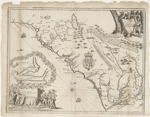
Cape Fear in modern-day Brunswick County projects into the Atlantic Ocean at the southeastern tip of Smith Island, near the mouth of the Cape Fear River and adjacent to the area known as Bald Head. The Frying Pan Shoals extend another 20 miles outward from Cape Fear. Known during various eras as Cape Feare, Cape Fair, and Cape Fayre, the cape maintains a significant place in North Carolina history. Sailing under the French flag, Italian explorer Giovanni da Verrazano may have been the first to encounter Cape Fear in 1524. During the period of the English Roanoke explorations, Sir Richard Grenville reported in June 1585 that the ship Tiger, en route to Roanoke Island, was nearly wrecked "on a breache called the Cape of Feare." In 1587 artist John White also nearly wrecked "upon the breach called Cape of Fear" on one of his voyages.
The southernmost point explored by the English during this period is designated as "Promontorium tremendum" on the 1590 de Bry map and has mistakenly been identified as Cape Fear in the past. Current cartographic researchers have established this cape as modern-day Cape Lookout and not Cape Fear. Other maps drawn during the seventeenth century-including those by Comberford (1657), Horne, (1666), Ogilby (1672), Gascoyne (1682), and Lea (1695)-show Cape Fear by name.
The name "Cape Fair" was used at times in the seventeenth century, when colonists were encouraged to settle the Carolina region. Under the leadership of William Hilton, explorers encountered Cape Fear in 1662 and sailed up the present Cape Fear River, then called the Charles, to the mouth of Town Creek, where they established a brief settlement. In his 1663 "Letter of the English Adventurers to the Lords Proprietors," Hilton referred to the "Point of Cape Fair River." Hilton's notes became the basis for the first accurate map of the region, prepared by Nicholas Shapley. In addition to Hilton's report, other sources that made mention of Cape Fair included the history and map of John Lawson, surveyor general in 1709, and Wimble's map of 1738. The name Cape Fair was not permanently accepted, and by the American Revolution Cape Fear had become the common designation both for the cape itself and for the region surrounding the lower basin of the Cape Fear River.