Copyright notice

This article is from the Encyclopedia of North Carolina edited by William S. Powell. Copyright © 2006 by the University of North Carolina Press. Used by permission of the publisher. For personal use and not for further distribution. Please submit permission requests for other use directly to the publisher.

Printer-friendly page

Climate and Weather

by Peter J. Robinson and Gregory B. Fishel, 2006

Part i: Introduction; Part ii: Climatic Factors, Precipitation Patterns, and Seasonal TrendsPart iii: Droughts and Floods in North Carolina

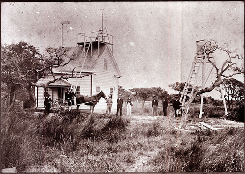
Part I: IntroductionWeather Station, Hatteras Village, Roanoke Island, NC, no date (c.1900-1909). From the General Negative Collection, NC State Archives, call #:  N-77-4-19.

Climate and Weather in North Carolina are as varied as that of any state, with four distinct seasons and a wide variety of conditions and storms, from paralyzing snowstorms in winter to major hurricanes in late summer and fall. Because the state's geography ranges from Atlantic coastline in the east to western mountains reaching several thousand feet in height, temperature extremes in North Carolina vary greatly from place to place and from season to season. The overall climate is relatively warm; even in the mountains, North Carolina's coldest region, the average temperature in January remains above freezing. The state's record low is -25°, recorded at Grandfather Mountain in Avery County on 30 Jan. 1966. North Carolina's highest recorded temperature, 110°, occurred at Fayetteville on 22 Aug. 1983. The frost-free season in the state ranges from an average of 170 days in the west to 280 days in the east.


Keep reading > Part II: Climatic Factors, Precipitation Patterns, and Seasonal Trends Keep reading

References:

Jay Barnes, North Carolina's Hurricane History (3rd ed., 2001).

Charles B. Carney and Albert V. Hardy, Weather and Climate in North Carolina (1963).

William S. Powell, North Carolina: The Story of a Special Kind of Place (1987).

Additional Resources:

"Geography of North Carolina," North Carolina Department of Public Instruction, http://www.ncpublicschools.org/curriculum/socialstudies/elementary/studentsampler/20geography#maps

"North Carolina: Facts, Map, and State Symbol," Enchanted Learning, last modified 2010, http://www.enchantedlearning.com/usa/states/northcarolina/

"North Carolina Geography and Climate," Secretary of State/Kids Page," http://www.secretary.state.nc.us/kidspg/

Image Credit:

Weather Station, Hatteras Village, Roanoke Island, NC, no date (c.1900-1909). From the General Negative Collection (original is in the H. H. Brimley Photograph Collection, PhC42_Bx7_Cape Hatteras_F10), North Carolina State Archives call #: N-77-4-19. Available from https://www.flickr.com/photos/north-carolina-state-archives/2434767382/ (accessed October 31, 2012).

Subjects: