Pender County Resources
- View All:
- Biographies
- Monuments
- locations
ANCHOR (A North Carolina History Online Resource) is now its own website!
Copyright Notice: This article is from the Encyclopedia of North Carolina edited by William S. Powell. Copyright © 2006 by the University of North Carolina Press. Used by permission of the publisher. For personal use and not for further distribution. Please submit permission requests for other use directly to the publisher.
See also: Moore's Creek Bridge, Battle of; Penderlea Homesteads; Rocketry Experiments; Sloop Point Plantation.
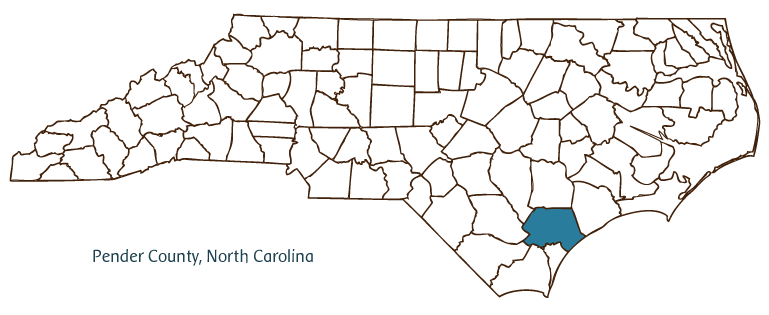
Pender County, located in the Coastal Plain region of North Carolina, was formed in 1875 from New Hanover County and named for Confederate general William D. Pender, who died at the Battle of Gettysburg in 1863. It is bordered in part by the Atlantic Ocean. Early inhabitants of the area included the Burgaw Indians, followed by English, German, Welsh, and French settlers. When establishment of the county seat was authorized in 1875, its name was to be Cowan; in 1877, however, the name was changed to Stanford and then, in 1879, changed again to Burgaw-which it has remained-when the city was officially incorporated. Beach communities important in the county's recreational and tourist trade are Topsail Beach and Surf City, and other communities include Hampstead, Scotts Hill, Penderlea, and Rocky Point. Notable physical features, in addition to the shoreline, include the Cape Fear River, Topsail Island (shared with Onslow County), Roan Island, and Beasley's, Rock Fish, and Colvins Creeks.
The Battle of Moore's Creek Bridge, the first southern battle and Patriot victory in the Revolutionary War, took place in what is now Pender County on 27 Feb. 1776. The battlefield is now a national historic site. Pender County's other historic sites include Sloop Point Plantation (1726), North Carolina's oldest house. Cultural institutions include Topsail Island Missiles and More Museum, commemorating the rocketry experiments of the late 1940s, the Penderlea Homestead Museum, and the Poplar Grove Plantation Museum House and Cultural Arts Center. The county hosts annual events such as Autumn with Topsail, Burgaw Pumpkin Day, the Atkinson Christmas Jubilee, and the Grape Festival.
Pender County's agricultural products include strawberries, blueberries, grapes, tobacco, sweet potatoes, soybeans, swine, and poultry, and its manufactures include apparel, crushed stone, and pressure sensitive labels. The rare Venus flytrap grows in the wild in Pender County. In 2004 the population of the county was estimated at slightly more than 45,000.
For an annotated history of the county's formation, with the laws affecting the county, boundary lines and changes, and other origin information, visit these references in The Formation of the North Carolina Counties (Corbitt, 2000), available online at North Carolina Digital Collections (note, there may be additional items of interest for the county not listed here):
County formation history: https://digital.ncdcr.gov/Documents/Detail/the-formation-of-the-north-ca...
Index entry for the county: https://digital.ncdcr.gov/Documents/Detail/the-formation-of-the-north-ca...
Additional resources:
Corbitt, David Leroy. 2000. The formation of the North Carolina counties, 1663-1943. https://digital.ncdcr.gov/Documents/Detail/the-formation-of-the-north-carolina-counties-1663-1943/3692099?item=4553233 (accessed June 20, 2017).
Pender County Government: https://pendercountync.gov/
Pender County Chamber of Commerce: https://www.visitpender.com/
DigitalNC, Pender County: https://www.digitalnc.org/counties/pender-county/
North Carolina Digital Collections (explore by place, time period, format): https://digital.ncdcr.gov
Image credits:
Rudersdorf, Amy. 2010. "NC County Maps." Government & Heritage Library, State Library of North Carolina.
Mazzocchi, Jay. "Pender County." NCpedia. Library of NC. 2006.

PENDER COUNTY GOVERNMENT:
www.pendercountync.gov
COUNTY SEAT:Burgaw
FORMED: 1875
FORMED FROM: New Hanover
LAND AREA: 869.80 square miles
2020 POPULATION ESTIMATE: 60,203
White: 81.5%
Black/African American: 14.7%
American Indian: 0.9%
Asian: 0.7%
Pacific Islander: 0.1%
Two or more races: 2.1%
Hispanic/Latino: 7.5% (of any race)
From State & County QuickFacts, US Census Bureau, 2020.
CONGRESSIONAL DISTRICT: 7TH
BIOGRAPHIES FOR![]()
Pender County
 WILDLIFE PROFILES FOR
Coastal Plain
GEOGRAPHIC INFORMATION
REGION: Coastal Plain
RIVER BASIN: Cape Fear, Map
NEIGHBORING COUNTIES: Bladen, Brunswick, Columbus, Duplin, Onslow, Sampson


