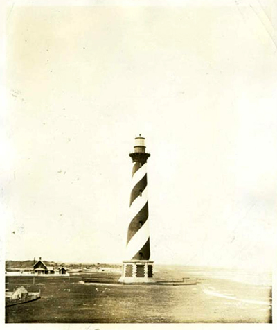
Photograph of the Cape Hatteras Lighthouse, ca. 1920-1940. Item H.1952.96.86 from the collection of the North Carolina Museum of History, used courtesy of NCDNCR.

Established: 1935
GPS Coordinates: 35.2505368,-75.5288298
Size: 1,200 acres
See also: Exploring North Carolina: North Carolina State Parks, Trails, Lakes, Rivers & Natural Areas

Cape Hatteras State Park is among a handful of North Carolina state parks that existed only for a brief time. On June 17, 1935, John S. Phipps donated land for a state park on the edge of the Outer Banks. The land was adjacent to the Hatteras Light House.

In the early years, park development plans included creation of facilities for picnicking, boating, and cabin lodging. On December 22, 1952, the state transferred the land to the federal government for inclusion in the Cape Hatteras National Seashore.

References:

North Carolina Department of Conservation and Development. North Carolina: today and tomorrow. 1936. North Carolina State Documents Collection, North Carolina Digital Collections. https://digital.ncdcr.gov/Documents/Detail/north-carolina-today-and-tomo... (accessed December 29, 2015).

North Carolina Department of Conservation and Development. North Carolina's Natural Resources. North Carolina Resource Bulletin Series, 1952. https://digital.ncdcr.gov/Documents/Detail/north-carolinas-natural-resou... (accessed December 29, 2015).

Image Credit:

[Cape Hatteras Lighthouse.] Photograph. ca. 1920-1940. Item H.1952.96.86 from the collection of the North Carolina Museum of History. https://www.ncmuseumofhistory.org/collections

Citation