Mitchell County Resources
- View All:
- Biographies
- Monuments
- locations
ANCHOR (A North Carolina History Online Resource) is now its own website!
Copyright Notice: This article is from the Encyclopedia of North Carolina edited by William S. Powell. Copyright © 2006 by the University of North Carolina Press. Used by permission of the publisher. For personal use and not for further distribution. Please submit permission requests for other use directly to the publisher.
See also: Penland School of Crafts.
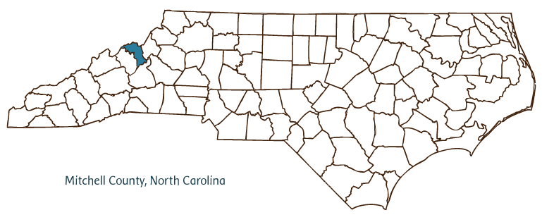
Mitchell County, located in the Mountain region of western North Carolina, was formed in 1861 from Yancey, Watauga, Caldwell, Burke, and McDowell Counties; it was named for University of North Carolina professor Elisha Mitchell, who died exploring the famous mountain peak in western North Carolina that now bears his name (Mount Mitchell, Yancey County). Mitchell County partially borders the state of Tennessee. Early inhabitants of the area included the Cherokee Indians, followed by German and Scotch-Irish settlers. The county seat, Bakersville, was incorporated in 1868, although it had been established for more than 10 years prior to that time. The town was named for David Baker, who received a land grant and settled in the area in 1797. Other Mitchell County communities include Spruce Pine, Bandana, Red Hill, Penland, and Poplar. The acreage of Mitchell County comprises a large section of the Pisgah National Forest. Notable physical features include the North Toe River, Big Yellow Mountain, Chalk Mountain, and Roan Mountain.
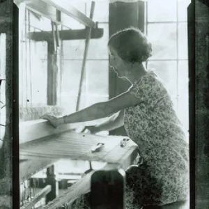
Mitchell County's Penland School of Crafts, established in 1929, is one of America's oldest and most successful handicraft schools. Other historic places include the English Inn, dating from the early nineteenth century, and the Lunday footbridge, constructed in the mid-twentieth century. Mitchell County cultural institutions include the North Carolina Mineral Museum and Twisted Laurel Gallery. Popular annual events held in the county include the Rhododendron Festival, Fall Festival of the Arts, Fire on the Mountain Blacksmith Festival, Mountaineer Festival, Music in the Mountains Folk Festival, and North Carolina Mineral and Gem Festival at Spruce Pine.
Mitchell County has one of the richest mineral deposits in the United States. Fifty-seven different minerals are mined there, including mica, emerald, aquamarine, quartz, garnet, sapphire, kaolin, and feldspar. The county's agricultural products include burley tobacco, horticultural crops, Christmas trees, and beef cattle, and its leading manufacture is furniture. Mitchell County's estimated population was 16,000 in 2004.
For an annotated history of the county's formation, with the laws affecting the county, boundary lines and changes, and other origin information, visit these references in The Formation of the North Carolina Counties (Corbitt, 2000), available online at North Carolina Digital Collections (note, there may be additional items of interest for the county not listed here):
County formation history: https://digital.ncdcr.gov/Documents/Detail/the-formation-of-the-north-ca...
Index entry for the county: https://digital.ncdcr.gov/Documents/Detail/the-formation-of-the-north-ca...
Additional resources:
Corbitt, David Leroy. The Formation of the North Carolina Counties, 1663-1943. Raleigh: Division of Archives and History, North Carolina Department of Cultural Resources, 1987. https://digital.ncdcr.gov/Documents/Detail/the-formation-of-the-north-carolina-counties-1663-1943/3692099?item=4553233 (accessed June 20, 2017).
Mitchell County Government. "Welcome to Mitchell County." https://www.mitchellcountync.gov/ (accessed February 15, 2019).
Mitchell County Chamber of Commerce. "Welcome to Mitchel County Chamber of Commerce." https://mitchellcountychamber.org/ (accessed February 15, 2019).
DigitalNC. "Mitchell County." NC Digital Heritage Center. https://www.digitalnc.org/counties/mitchell-county/ (accessed February 15, 2019).
North Carolina Digital Collections. "Explore by ... [place, time period, format]." North Carolina Department of Natural and Cultural Resources. https://digital.ncdcr.gov (accessed February 15, 2019).
Image credits:
Rudersdorf, Amy. "NC County Maps." Raleigh: Government & Heritage Library, State Library of North Carolina, 2010.
Mazzocchi, Jay. "Mitchell County." NCpedia. Library of NC. February 2024.
MITCHELL COUNTY GOVERNMENT:
https://www.mitchellcountync.gov/
COUNTY SEAT: Bakersville
FORMED: 1861
FORMED FROM: Yancey, Watauga, Caldwell, Burke, McDowell
LAND AREA: 221.43 square miles
2020 POPULATION ESTIMATE: 14,903
White: 96.0%
Black/African American: 0.8%
American Indian: 0.9%
Asian: 0.7%
Pacific Islander: 0.2%
Two or more races: 1.4%
Hispanic/Latino: 6.2% (of any race)
From State & County QuickFacts, US Census Bureau, 2020.
CONGRESSIONAL DISTRICT: 11TH
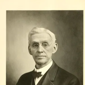
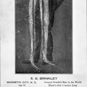
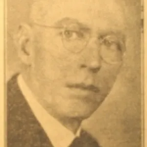
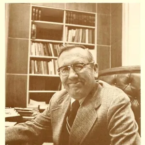
BIOGRAPHIES FOR![]()
Mitchell County
![]() WILDLIFE PROFILES FOR
WILDLIFE PROFILES FOR
Mountain region
GEOGRAPHIC INFORMATION
REGION: Mountain
RIVER BASIN: French Broad, Map
NEIGHBORING COUNTIES: Avery, McDowell, Yancey