Burke County Resources
- View All:
- Biographies
- Monuments
- locations
ANCHOR (A North Carolina History Online Resource) is now its own website!
We have rescheduled our maintenance on NCpedia to Friday, May 22, beginning at 3 pm. You may experience access issues over the weekend (May 23 and 24). We apologize for the inconvenience.
Copyright Notice: This article is from the Encyclopedia of North Carolina edited by William S. Powell. Copyright © 2006 by the University of North Carolina Press. Used by permission of the publisher. For personal use and not for further distribution. Please submit permission requests for other use directly to the publisher.
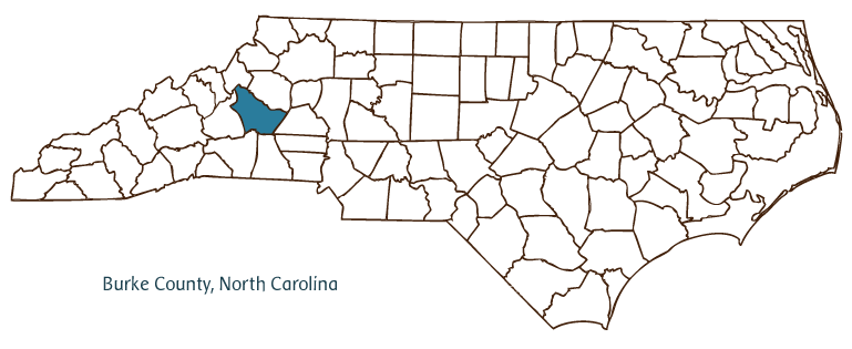
Burke County is located in west central North Carolina, in the state's Mountain region. It was formed in 1777 and named for Thomas Burke, delegate to the Continental Congress and governor of the state (1781-82). The county originally comprised substantial territory in the western part of the state, and portions of it later formed counties including Alexander, Buncombe, Caldwell, Catawba, Madison, Mitchell, McDowell, and Yancey. Its present borders have been settled since 1834. Morganton, the county seat and largest city, was incorporated in 1784 and named for Gen. Daniel Morgan, the Revolutionary War soldier who led Continental troops at the Battles of King's Mountain and Cowpens. Other Burke County communities include Connelly Springs, Drexel, Glen Alpine, Hildebran, Rhodhiss (on the Caldwell County line), and Valdese. A small western portion of the city of Hickory also lies within Burke County, although most of the city is located in neighboring Catawba County. Similarly, the town of Long View is also located in both Catawba and Burke Counties.
Catawba and Cherokee Indians were the primary inhabitants of the lands that became Burke County when English, Scotch-Irish, and German settlers first moved into the area. During the late eighteenth and early nineteenth centuries, many of these settlers came from Pennsylvania, having traveled south through the Shenandoah Valley along what came to be known as the Great Wagon Road. After the Civil War, the development of the Southern Railroad through Burke County led to increased contact with the rest of the state and region and brought industrial development to Morganton and the county's smaller communities.
The county's economy today is diversified. Industrial products include furniture, chemicals, machine parts, and textiles, although the textile industry in Burke County has diminished sharply in recent years, mirroring developments elsewhere in the state. The county is also home to a significant agricultural processing industry, and it is one of the state's largest producers of forest products, including Christmas trees, and ornamental plants. Burke County has the highest proportion of state government employees outside of Raleigh. Important state institutions in the county include the North Carolina School for the Deaf; Broughton Hospital and Western Carolina Hospital, which serve the state's mental health needs; and Western Correctional Center, a state prison. The Historic Burke Foundation operates Quaker Meadows, the Revolutionary-era home of the McDowell family, and Western Piedmont Community College houses the library and re-created office of Senator Sam J. Ervin Jr.
Burke County is known for its natural resources and parklands, which contribute to a thriving tourism industry. Lake James State Park and South Mountains State Park are both located in the county, as is a portion of the Pisgah National Forest. Because of the size of these park and forest lands, the U.S. government and the state of North Carolina are two of the three largest landholders in the county. (The third is Duke Energy, whose predecessor companies created 6,510-acre Lake James in the 1910s and which today operates several hydroelectric facilities in the county.) The Blue Ridge Parkway runs through the far northwestern corner of the county, past the Linville Gorge Wilderness Area and its popular Linville Falls as well as other destinations for hiking, camping, mountain biking, and nature study. The population of Burke County in 2004 was estimated to be 89,000.
For an annotated history of the county's formation, with the laws affecting the county, boundary lines and changes, and other origin information, visit these references in The Formation of the North Carolina Counties (Corbitt, 2000), available online at North Carolina Digital Collections (note, there may be additional items of interest for the county not listed here):
County formation history: https://digital.ncdcr.gov/Documents/Detail/the-formation-of-the-north-ca...
Index entry for the county: https://digital.ncdcr.gov/Documents/Detail/the-formation-of-the-north-ca...
Burke County has earned the nickname "The Western Capital of North Carolina" because of the large presence of North Carolina state government entities in the county. One of the earliest published appearances of this nickname is in W. C. Carson's 1888 Catawba Valley and Highlands.
-- Kelly Agan, N.C. Government & Heritage Library
References:
Edward W. Phifer Jr., Burke County: A Brief History (1979).
Additional resources:
Corbitt, David Leroy. 2000. The formation of the North Carolina counties, 1663-1943. https://digital.ncdcr.gov/Documents/Detail/the-formation-of-the-north-carolina-counties-1663-1943/3692099?item=4553233 (accessed June 20, 2017).
Burke County Government:http://www.burkenc.org/
Burke County Chamber of Commerce: https://burkecountychamber.org/
DigitalNC, Burke County: https://www.digitalnc.org/counties/burke-county/
North Carolina Digital Collections (explore by place, time period, format): https://digital.ncdcr.gov
Image credits:
Rudersdorf, Amy. 2010. "NC County Maps." Government & Heritage Library, State Library of North Carolina.
Bangma, Peter. "Burke County." NCpedia. Library of NC. January 2024.

BURKE COUNTY GOVERNMENT: http://www.burkenc.org/
COUNTY SEAT: Morganton
FORMED: 1777
FORMED FROM: Rowan
LAND AREA: 507.10 square miles
2020 POPULATION ESTIMATE: 87,570
White: 86.1%
Black/African American: 6.9%
American Indian: 0.9%
Asian: 3.6%
Pacific Islander: 0.7%
Two or more races: 1.8%
Hispanic/Latino: 6.5% (of any race)
From State & County QuickFacts, US Census Bureau, 2020.
CONGRESSIONAL DISTRICT: 11TH
BIOGRAPHIES FOR![]()
Burke County
 WILDLIFE PROFILES FOR
Mountain region
GEOGRAPHIC INFORMATION
REGION: Mountain, though some areas are technically in the Piedmont
RIVER BASIN: Catawba, Map
NEIGHBORING COUNTIES: Avery, Caldwell, Catawba, Cleveland, McDowell, Rutherford


