Haywood County Resources
- View All:
- Biographies
- Monuments
- locations
ANCHOR (A North Carolina History Online Resource) is now its own website!
Copyright Notice: This article is from the Encyclopedia of North Carolina edited by William S. Powell. Copyright © 2006 by the University of North Carolina Press. Used by permission of the publisher. For personal use and not for further distribution. Please submit permission requests for other use directly to the publisher.
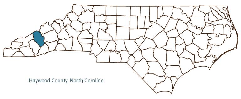
Haywood County, located in North Carolina's Mountain region, was formed from Buncombe County in 1808 and took its name from John Haywood, the state treasurer at the time. The Great Smoky Mountains National Park and Pisgah National Forest comprise some 40 percent of the county's land area and are key elements in the county's economy and culture. Communities in Haywood County include the county seat of Waynesville, founded in 1810, Canton, Clyde, Maggie Valley, and Hazelwood.
Haywood County was home to a thriving Cherokee culture when Europeans arrived in the sixteenth and seventeenth centuries, but smallpox devastated their numbers in 1715 and the Cherokee were eventually forced westward. In the decades following the Revolutionary War, the area attracted a large number of white settlers, many of Scotch-Irish, German, and Dutch descent. Despite its isolated location, the casualties and ruin brought on by the Civil War, and the loss of land for the formation of other counties, Haywood County continued to draw settlers. The creation of the Western North Carolina Railroad in the 1880s provided a boon to its limited agrarian economy and elevated new industries such as logging and tourism to prominence.
Modernization in Haywood County was slow but steady during the twentieth century, and sluggish population growth was compensated for by the influx of tourists and the expansion of facilities to accommodate them, such as North Carolina's first ski resort at Cataloochee Ranch. The county also hosts several festivals related to mountain heritage and culture, including the annual Singing in the Valley, the Stompin' Ground Clogging Competition, and the Smoky Mountain Folk Festival. The Folkmoot USA festival, a popular multicultural celebration of music and dance, is held in Haywood County each summer. County agricultural products include apples, tomatoes, chickens, and beef and dairy cattle. In 2004 the estimated population of Haywood County was 56,500.
For an annotated history of the county's formation, with the laws affecting the county, boundary lines and changes, and other origin information, visit these references in The Formation of the North Carolina Counties (Corbitt, 2000), available online at North Carolina Digital Collections (note, there may be additional items of interest for the county not listed here):
County formation history: https://digital.ncdcr.gov/Documents/Detail/the-formation-of-the-north-ca...
Index entry for the county: https://digital.ncdcr.gov/Documents/Detail/the-formation-of-the-north-ca...
References:
Haywood County Heritage, North Carolina (1994).
W. Clark Medford, The Early History of Haywood County (1961).
Medford, The Middle History of Haywood County (1968).
Additional resources:
Corbitt, David Leroy. 2000. The formation of the North Carolina counties, 1663-1943. https://digital.ncdcr.gov/Documents/Detail/the-formation-of-the-north-carolina-counties-1663-1943/3692099?item=4553233 (accessed June 20, 2017).
Haywood County Government: https://www.haywoodcountync.gov/
Haywood County Chamber of Commerce: https://www.haywoodchamber.com/
DigitalNC, Haywood County: https://www.digitalnc.org/counties/haywood-county/
North Carolina Digital Collections (explore by place, time period, format): https://digital.ncdcr.gov
Image credits:
Rudersdorf, Amy. 2010. "NC County Maps." Government & Heritage Library, State Library of North Carolina.
Vocci, Robert Blair. "Haywood County." NCpedia. Library of NC. 2006.
HAYWOOD COUNTY GOVERNMENT:
https://www.haywoodcountync.gov/
COUNTY SEAT: Waynesville
FORMED: 1808
FORMED FROM: Buncombe
LAND AREA: 553.69 square miles
2020 POPULATION ESTIMATE: 62,089
White: 95.9%
Black/African American: 1.4%
American Indian: 0.7%
Asian: 0.6%
Pacific Islander: <0.1%
Two or more races: 1.4%
Hispanic/Latino: 4.3% (of any race)
From State & County QuickFacts, US Census Bureau, 2020.
CONGRESSIONAL DISTRICT: 11TH
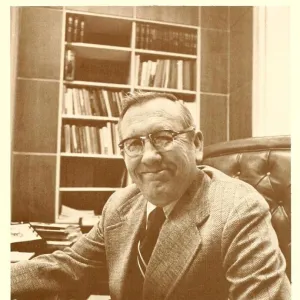
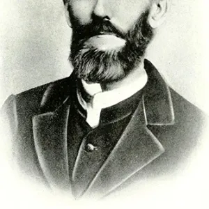
BIOGRAPHIES FOR![]()
Haywood County
 WILDLIFE PROFILES FOR
Mountain region
GEOGRAPHIC INFORMATION
REGION: Mountain
RIVER BASIN: French Broad, Map
NEIGHBORING COUNTIES: Buncombe, Jackson, Madison, Swain, Transylvania