Transylvania County Resources
- View All:
- Biographies
- Monuments
- locations
ANCHOR (A North Carolina History Online Resource) is now its own website!
Copyright Notice: This article is from the Encyclopedia of North Carolina edited by William S. Powell. Copyright © 2006 by the University of North Carolina Press. Used by permission of the publisher. For personal use and not for further distribution. Please submit permission requests for other use directly to the publisher.
See also: Biltmore Forest School; Brevard College; Brevard Music Center.
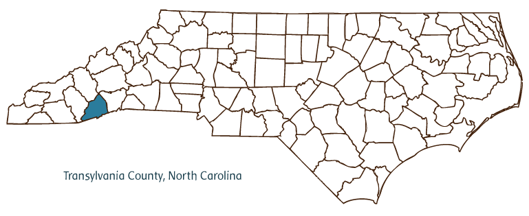
Transylvania County is located in the Mountain region of southwestern North Carolina along the South Carolina border. It was formed in 1861 from portions of Jackson and Henderson Counties. Its county seat, Brevard, was established in 1861 but not incorporated until 1889. Its other communities include Cedar Mountain, Cherryfield, Lake Toxaway, Little River, Penrose, Pisgah Forest, and Sapphire.
The forests and mountains of Transylvania County were home to the Cherokee Indians until federal legislation in 1830 forced the relocation of most North Carolina Cherokee to Oklahoma. English, Scotch-Irish, and Welsh settlers came to the region by way of Cherokee trading paths and river routes along the Davidson River and other tributaries in the French Broad River and Savannah River basins, but the county remained lightly populated through the early nineteenth century, home primarily to yeoman farmers. In the late nineteenth century, industrialist George Vanderbilt acquired large tracts of forest land in the county, and in 1895 he hired Carl A. Schenck to manage the lands for timber harvest and conservation. The lands today comprise portions of Pisgah National Forest, nearly 83,000 acres of which is located in Transylvania County. The Cradle of Forestry in America historic site in northern Transylvania County, on the site of the Biltmore Forest School founded by Schenck in 1898, commemorates the role of the school and the county in the development of modern forestry. The county remains an important producer of timber and timber products.
The growth of Brevard and the county generally increased beginning in 1895, when the Henderson & Brevard Railroad (later the Transylvania Railroad Company) came to town. The railroad brought increased commerce and tourism, which in turn sparked development of luxurious resort towns such as Lake Toxaway. A major human and ecological disaster struck, however, when the Lake Toxaway dam broke during a major flood that struck western North Carolina in 1916. The flood destroyed many small farming communities downstream, left Lake Toxaway dry, and led to the failure of the resort. Piles of timber debris from the 1916 flood can still be seen in the area today.
In 1934 Brevard College was founded on the campus of Epworth School, an important early institute for girls and young women in western North Carolina. The college in time earned a strong reputation for education in the arts and in the environmental sciences. Brevard's reputation as an artistic community was also enhanced by the Brevard Music Center, established in 1945 and home to one of the finest summer music festivals and master class programs in the country. By the early twenty-first century, Transylvania County was firmly established as a popular mountain destination for tourists drawn to the county's natural environment and recreational opportunities. The county is popularly billed as the "Land of Waterfalls" on account of its more than 250 falls, including Looking Glass Falls, Sliding Rock Falls, and Whitewater Falls, which, at some 411 feet, is considered the highest cascade east of the Rocky Mountains. Gorges State Park, near Sapphire, was established in 1999 on land purchased from Duke Energy Corporation. The estimated population of Transylvania County was 29,700 in 2004.
For an annotated history of the county's formation, with the laws affecting the county, boundary lines and changes, and other origin information, visit these references in The Formation of the North Carolina Counties (Corbitt, 2000), available online at North Carolina Digital Collections (note, there may be additional items of interest for the county not listed here):
County formation history: https://digital.ncdcr.gov/Documents/Detail/the-formation-of-the-north-ca...
Index entry for the county: https://digital.ncdcr.gov/Documents/Detail/the-formation-of-the-north-ca...
Additional resources:
Corbitt, David Leroy. 2000. The formation of the North Carolina counties, 1663-1943. https://digital.ncdcr.gov/Documents/Detail/the-formation-of-the-north-carolina-counties-1663-1943/3692099?item=4553233 (accessed June 20, 2017).
Transylvania County Government: https://www.transylvaniacounty.org/
Brevard / Transylvania County Chamber of Commerce: https://brevardncchamber.org/
Transylvania County Tourism Development Authority: https://explorebrevard.com/
DigitalNC, Transylvania County: https://www.digitalnc.org/counties/transylvania-county/
North Carolina Digital Collections (explore by place, time period, format): https://digital.ncdcr.gov
Image credits:
Rudersdorf, Amy. 2010. "NC County Maps." Government & Heritage Library, Library of North Carolina.
Bangma, Peter. "Transylvania County." NCpedia. Library of NC. 2006.
TRANSYLVANIA COUNTY GOVERNMENT:
www.transylvaniacounty.org
COUNTY SEAT: Brevard
FORMED: 1861
FORMED FROM: Henderson, Jackson
LAND AREA: 378.53 square miles
2020 POPULATION ESTIMATE: 32,986
White: 93.4%
Black/African American: 3.5%
American Indian: 0.5%
Asian: 0.7%
Pacific Islander: 0.1%
Two or more races: 1.9%
Hispanic/Latino: 3.4% (of any race)
From State & County QuickFacts, US Census Bureau, 2020.
CONGRESSIONAL DISTRICT: 11TH
BIOGRAPHIES FOR![]()
Transylvania County
 WILDLIFE PROFILES FOR
Mountain region
GEOGRAPHIC INFORMATION
REGION: Mountain
RIVER BASIN: French Broad, Savannah, Map
NEIGHBORING COUNTIES: Haywood, Henderson, Jackson


