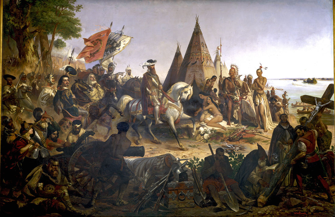
Hernando De Soto traveled through the region that would become the southeastern United States from 1539 to 1543. He traveled with an army of more than 600 men in an attempt to discover riches comparable to those found in Mexico and Peru. The Spanish Monarchy granted De Soto the right to oversee the conquest of La Florida (the name given to peninsular Florida and the land between the Gulf and Atlantic Coasts). Although he traveled almost 4,000 miles and found many bountiful lands, he discovered no gold or silver and very few gems. During his passage, De Soto and his soldiers wreaked havoc on the chiefdoms of the many southeastern American Indian tribes and their people. This soured relations between the conquistadors and the Native tribes who were originally friendly. The De Soto expedition relied on American Indian guides for direction, while also confiscating food supplies and enslaving people from Native tribes. The approach that he and his army practiced is known as a "scorched-earth" policy. De Soto died in Louisiana and was buried by his soldiers in the Mississippi River on May 21, 1542. Agitated Native tribes continued to retaliate against De Soto’s expedition team after his death until the remnants of his army (reduced to just over 300 men) ultimately fled La Florida. They sailed from the mouth of the Mississippi along the Gulf Coast until they reached Spanish settlements in Mexico.
The actual route that De Soto followed through the Southeast has been the source of much scholarly inquiry. In 1935 the U.S. Congress authorized a comprehensive study of the De Soto expedition to identify and mark his route. The U.S. De Soto Expedition Commission, led by ethnologist John Swanton, published its findings in 1939. According to the commission's report, De Soto's army entered the far western part of present-day North Carolina and passed through what would become Macon, Clay, and Cherokee Counties. Research by Charles Hudson and his colleagues suggests a route that includes a larger area of western North Carolina. According to this research, De Soto and his army reached the Chiefdom of Cofitachequi, located in the vicinity of present-day Camden, S.C.
The purpose of the De Soto expedition was to uncover additional sources of gold and silver for Spain. The chieftainess of the Cofitachequi people informed De Soto of potential gold and silver sources in the Blue Ridge mountains during their meeting. De Soto and his soldiers enslaved the chieftainess as a hostage and departed Cofitachequi on May 12, 1540. The Spanish wanted her to direct their expedition. His force traveled north following the Wateree/Catawba River Valley. Within two days they encountered villages referred to as being in the territory of Chalaque. This region, described as unimpressive with little corn available, is thought to have been just southwest of Charlotte. The term Chalaque has been Anglicized as Cherokee. Continuing north, De Soto and his men reached the town of Guaquili, possibly in the vicinity of Hickory. From Guaquili, they headed west and arrived at Xuala or Joara, thought to be the principal town of the Chiefdom of Joara. Archaeological evidence suggests that this town was located just north of Morganton. De Soto’s expedition left Joara on May 25, and marched north into the Blue Ridge. During this march, the chieftainess of the Cofitachequi and a person enslaved with her escaped and returned to their tribe. The expedition followed the North Toe River until it crossed the Cane River. There, they reached the Nolichucky River and the town of Guasili on May 30, 1540. Guasili may have been located near present-day Embreeville, Tennessee.
De Soto likely met with ancestors of both the Catawba (Wateree) and the Cherokee (Chalaque) tribes as he crossed through western North Carolina. His journey was significant at the time because it was the first to inform Europeans “of the geography, climate, Native people, plants, and animals of the Southeast.” His journey is significant today to historians, anthropologists, and archaeologists due to the written accounts that provide the first historical glimpses of the often large and complex chiefdom societies of southeastern American Indian people.