Anson County Resources
- View All:
- Biographies
- Monuments
- locations
ANCHOR (A North Carolina History Online Resource) is now its own website!
Copyright Notice: This article is from the Encyclopedia of North Carolina edited by William S. Powell. Copyright © 2006 by the University of North Carolina Press. Used by permission of the publisher. For personal use and not for further distribution. Please submit permission requests for other use directly to the publisher.
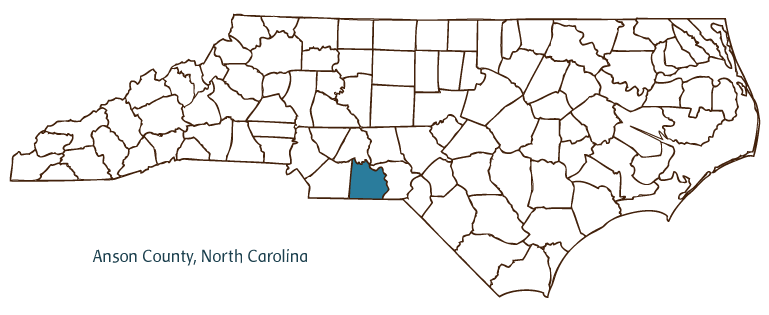 Anson County, located on the eastern edge of North Carolina's Piedmont region, along the South Carolina border, was formed in 1750 with the division of Bladen County. The county takes its name from George Lord Anson (1697-1762), then First Lord of the British Admiralty. For a time, Anson County was one of the largest territories in the colony, with borders that theoretically extended westward as far as the Mississippi River. Later, portions of Anson County became Mecklenburg, Montgomery, Richmond, and Union Counties. Its county seat, Wadesboro, was established in 1783 and was known as New Town until 1787, when it was renamed for Revolutionary War soldier and North Carolina legislator Col. Thomas Wade. Other communities in the county include Ansonville, Cedar Hill, Lilesville, McFarlan, Morven, Peachland, Polkton, Pee Dee, and White Store.
Anson County was home to a considerable population of Catawba and Cheraw Indians, whose settlements along the Pee Dee River offered important trading outposts for British and Scot-Irish immigrants who came to the region. Today, the Pee Dee River region in the county's northeast is home to the 8,443-acre Pee Dee National Wildlife Refuge, one of ten such refuges in the state.
Anson County remained largely rural throughout the eighteenth and nineteenth centuries. Leonidas L. Polk, North Carolina's first commissioner of agriculture and president of the National Farmers' Alliance, was born in the county and founded the town of Polkton in 1875. As in other Piedmont counties, textile production became an increasingly important part of the local economy in the nineteenth century. Anson County was the site of the nation's first soil conservation district, Brown Creek, established in 1937.
In the middle and late twentieth century, growth in nearby Charlotte and surrounding areas led to some increased growth in Anson County. By the early twenty-first century it remained largely rural and small in overall population, but a growing number of residents were moving to the county for its quiet lifestyle within a relatively short distance of the Charlotte-Mecklenburg metropolitan area. Anson County's population was estimated to be 25,700 in 2004.
For an annotated history of the county's formation, with the laws affecting the county, boundary lines and changes, and other origin information, visit these references in The Formation of the North Carolina Counties (Corbitt, 2000), available online at North Carolina Digital Collections (note, there may be additional items of interest for the county not listed here):
County formation history: https://digital.ncdcr.gov/Documents/Detail/the-formation-of-the-north-carolina-counties-1663-1943/3692099?item=4553272
Index entry for the county: https://digital.ncdcr.gov/Documents/Detail/the-formation-of-the-north-carolina-counties-1663-1943/3692099?item=4553577
Reference:
Mary L. Medley, History of Anson County, North Carolina, 1750-1976 (1976).
Additional resources:
Corbitt, David Leroy. 2000. The formation of the North Carolina counties, 1663-1943. https://digital.ncdcr.gov/Documents/Detail/the-formation-of-the-north-carolina-counties-1663-1943/3692099?item=4553272 (accessed June 20, 2017).
Anson County Government: http://www.co.anson.nc.us/
Anson County Chamber of Commerce: http://ansoncountychamber.org
DigitalNC, Anson County: https://www.digitalnc.org/counties/anson-county/
North Carolina Digital Collections (explore by place, time period, format): https://digital.ncdcr.gov
Image credits:
Rudersdorf, Amy. 2010. "NC County Maps." Government & Heritage Library, Library of North Carolina.
Bangma, Peter. "Anson County." NCpedia. Library of NC. July 2023.
ANSON COUNTY GOVERNMENT:
http://www.co.anson.nc.us/
COUNTY SEAT: Wadesboro
FORMED: 1750
FORMED FROM: Bladen
LAND AREA: 531.45 square miles
2020 POPULATION ESTIMATE: 22,055
White: 47.4%
Black/African American: 48.5%
American Indian: 0.9%
Asian: 1.5%
Pacific Islander: 0.1%
Two or more races: 1.7%
Hispanic/Latino: 4.1% (of any race)
From State & County QuickFacts, US Census Bureau, 2020.
CONGRESSIONAL DISTRICT: 9TH
BIOGRAPHIES FOR
Anson County![]()
![]() WILDLIFE PROFILES FOR
WILDLIFE PROFILES FOR
Piedmont region
GEOGRAPHIC INFORMATION
REGION: Piedmont
RIVER BASIN: Yadkin-Pee Dee, Map
NEIGHBORING COUNTIES: Montgomery, Richmond, Stanly, Union