Montgomery County Resources
- View All:
- Biographies
- Monuments
- locations
ANCHOR (A North Carolina History Online Resource) is now its own website!
We have rescheduled our maintenance on NCpedia to Friday, May 22, beginning at 3 pm. You may experience access issues over the weekend (May 23 and 24). We apologize for the inconvenience.
Copyright Notice: This article is from the Encyclopedia of North Carolina edited by William S. Powell. Copyright © 2006 by the University of North Carolina Press. Used by permission of the publisher. For personal use and not for further distribution. Please submit permission requests for other use directly to the publisher.
See also: Town Creek Indian Mound.
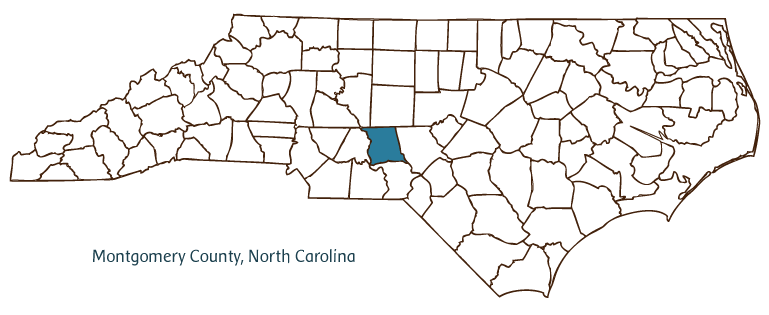
Montgomery County, located in the Piedmont region of south central North Carolina, was formed in 1779 from Anson County and named for Gen. Richard Montgomery, a Revolutionary War brigadier who was killed at the Battle of Quebec. The early inhabitants of the region were Keyauwee and Saura (Cheraw) Indians, followed by German and Scottish settlers. The county seat, Troy, was incorporated in 1852 and named for either the ancient city of Troy, North Carolina General Assembly member John B. Troy, or Robert Troy, a member of the North Carolina State House. Other communities in the county include Steeds, Ether, Star, Pekin, Wadeville, Uwharrie, Eldorado, and Mount Gilead.
A large section of Montgomery County is covered by the Uwharrie National Forest, which dominates much of the region's character and economy. Other notable physical features include Badin Lake, sections of the Yadkin-Pee Dee River, Lick Fork, Shelter Mountain, Horse Trough Mountain, Cheek Creek, and Drowning Creek. The county's farms produce cotton, tobacco, livestock, poultry, dairy products, and a variety of vegetables. Manufactured products include textiles, furniture, lumber, clay products, rugs, and shoes. Montgomery County has minerals such as clay, gold, silver, and copper.
Montgomery County historic attractions include the Town Creek Indian Mound State Historic Site, the location of a 600-year-old Native American ceremonial center, which is still being excavated. The Montgomery Arts Council, the Montgomery Community Theater, and the Roller Mill Historical Museum are a few of the county's cultural institutions. Montgomery County hosts annual festivals and events such as the Indian Heritage Festival, the Troy Fest, the Mount Gilead Christmas Parade, and the Star Christmas Parade. Montgomery County's population was estimated at just over 27,000 in 2004.
For an annotated history of the county's formation, with the laws affecting the county, boundary lines and changes, and other origin information, visit these references in The Formation of the North Carolina Counties (Corbitt, 2000), available online at North Carolina Digital Collections (note, there may be additional items of interest for the county not listed here):
County formation history: https://digital.ncdcr.gov/Documents/Detail/the-formation-of-the-north-ca...
Index entry for the county: https://digital.ncdcr.gov/Documents/Detail/the-formation-of-the-north-ca...
On August 8, 1889 the Carolina Watchman ran an article on the front page of the paper, written by C. W. Wooley, Sr. and giving an account of the history of Mongtomery County. In the article, Wooley disputed the attribution in Wheeler's History [Historical Sketches of North Carolina] of the naming of Troy for John B. Troy. He stated that it was in fact named for Alexander Troy, identified by Wooley as a former state solicitor. Wooley identified himself as clerk of the Montgomery County court from 1841 to 1849 and stated that he was present at the commissioner's meeting when the name was adopted.
Additional resources:
Corbitt, David Leroy. 2000. The formation of the North Carolina counties, 1663-1943. https://digital.ncdcr.gov/Documents/Detail/the-formation-of-the-north-carolina-counties-1663-1943/3692099?item=4553233 (accessed June 20, 2017).
Montgomery County Government: https://www.montgomerycountync.com/
DigitalNC, Montgomery County: https://www.digitalnc.org/counties/montgomery-county/
Town Creek Indian Mound: https://historicsites.nc.gov/all-sites/town-creek-indian-mound
Carolina Watchman (Salisbury, N.C.), August 8, 1889. https://newspapers.digitalnc.org/lccn/sn84026488/1889-08-08/ed-1/seq-1/ (accessed April 12, 2015).
North Carolina Digital Collections (explore by place, time period, format): https://digital.ncdcr.gov
Image credits:
Rudersdorf, Amy. 2010. "NC County Maps." Government & Heritage Library, State Library of North Carolina.
Powell, William S. "Montgomery County." NCpedia. Library of NC. 2006.

MONTGOMERY COUNTY GOVERNMENT:
www.montgomerycountync.com
COUNTY SEAT: Troy
FORMED: 1779
FORMED FROM: Anson
LAND AREA: 491.76 square miles
2020 POPULATION ESTIMATE: 25,751
White: 76.4%
Black/African American: 19.0%
American Indian: 1.1%
Asian: 1.6%
Pacific Islander: 0.1%
Two or more races: 1.8%
Hispanic/Latino: 15.6% (of any race)
From State & County QuickFacts, US Census Bureau, 2020.
CONGRESSIONAL DISTRICT: 8TH
BIOGRAPHIES FOR![]()
Montgomery County
 WILDLIFE PROFILES FOR
Piedmont region
GEOGRAPHIC INFORMATION
REGION: Piedmont
RIVER BASIN: Yadkin-Pee Dee, though some areas technically fall in the Cape Fear and Lumber River Basins.
NEIGHBORING COUNTIES: Davidson, Moore, Randolph, Richmond, Stanly


