Gates County Resources
- View All:
- Biographies
- Monuments
- locations
ANCHOR (A North Carolina History Online Resource) is now its own website!
Copyright Notice: This article is from the Encyclopedia of North Carolina edited by William S. Powell. Copyright © 2006 by the University of North Carolina Press. Used by permission of the publisher. For personal use and not for further distribution. Please submit permission requests for other use directly to the publisher.

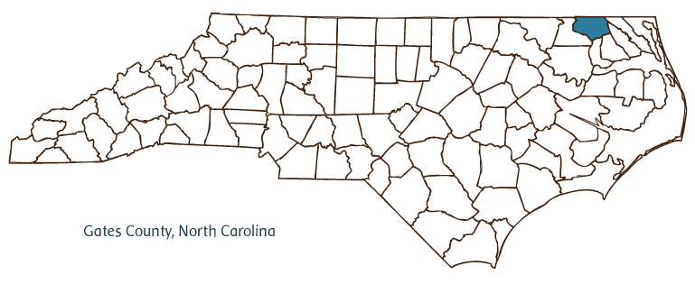
Gates County, located in the Coastal Plain region of northeastern North Carolina, was formed in 1779 from parts of Chowan, Hertford, and Perquimans Counties. Its northern border runs along the Virginia-North Carolina state line. It was named for General Horatio Gates, an American brigadier general in the Revolutionary War who led his troops to victory at the Battle of Saratoga in 1777. Gatesville has always been the county seat, although it was until 1831 called Gates Court House. Other Gates County communities include Eure, Hobbsville, Corapeake, and Sunbury.
Beginning in 1660, English colonists settled areas that had originally been inhabited by Nottoway, Meherrin, Chesapeake, Chowanoac, and Nansemond Indians. The economy of the county's rural communities was built around farming and timber. The coming of railroads in the late nineteenth century boosted the economy, as improved transportation made agriculture and lumbering more profitable. In the twentieth century, railroads were eventually superseded by highways, which allowed the cheaper option of truck shipment. Agriculture and lumbering are still the leading commercial enterprises in Gates County.
Gates County encompasses part of the Great Dismal Swamp National Wildlife Refuge, containing thousands of acres of forested wetlands. Other natural attractions in the county include Merchants Millpond State Park and the Chowan Swamp Game Land. Historic sites and cultural events include the Gates County Courthouse (1836) and the Fall Arts and Crafts Festival and the Gates County Swamp Fest. The population of Gates County was estimated to be 11,000 in 2004.
For an annotated history of the county's formation, with the laws affecting the county, boundary lines and changes, and other origin information, visit these references in The Formation of the North Carolina Counties (Corbitt, 2000), available online at North Carolina Digital Collections (note, there may be additional items of interest for the county not listed here):
County formation history: https://digital.ncdcr.gov/Documents/Detail/the-formation-of-the-north-ca...
Index entry for the county: https://digital.ncdcr.gov/Documents/Detail/the-formation-of-the-north-ca...
References:
Thomas R. Butchko, Forgotten Gates: The Historical Architecture of a Rural North Carolina County (1991).
Beverly and Glenn Tetterton, North Carolina County Fact Book (2 vols., 1998).
Paulette Felton Wester, A Journey in Time: A History of Gates County (1995).
Additional resources:
Corbitt, David Leroy. 2000. The formation of the North Carolina counties, 1663-1943. https://digital.ncdcr.gov/Documents/Detail/the-formation-of-the-north-carolina-counties-1663-1943/3692099?item=4553233 (accessed June 20, 2017).
Gates County Government: http://www.gatescounty.govoffice2.com/
DigitalNC, Gates County: https://www.digitalnc.org/counties/gates-county/
North Carolina Digital Collections (explore by place, time period, format): https://digital.ncdcr.gov
Image credits:
Rudersdorf, Amy. 2010. "NC County Maps." Government & Heritage Library, State Library of North Carolina.
Criner, Allyson C. "Gates County." NCpedia. State Library of NC. 2006. https://www.ncpedia.org/geography/gates.