Dare County Resources
- View All:
- Biographies
- Monuments
- locations
ANCHOR (A North Carolina History Online Resource) is now its own website!
Copyright Notice: This article is from the Encyclopedia of North Carolina edited by William S. Powell. Copyright © 2006 by the University of North Carolina Press. Used by permission of the publisher. For personal use and not for further distribution. Please submit permission requests for other use directly to the publisher.
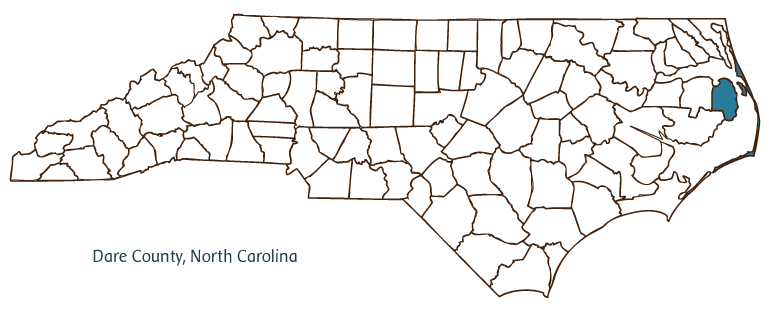
Dare County, located in northeastern North Carolina along the Atlantic seaboard, was formed from Currituck, Tyrrell, and Hyde Counties in 1870. It was named in honor of Virginia Dare, the first English child born in America. The county contains Roanoke Island, much of North Carolina's Outer Banks, and approximately 85 miles of continuous coastline (the longest of any North Carolina county). Communities in the county include Kill Devil Hills, Kitty Hawk, Nags Head, Southern Shores, and Wanchese. The county seat, Manteo, was named for a local Indian chief who aided the Roanoke Island colony and was taken to England in 1584 by men in the service of Sir Walter Raleigh.
Dare County was originally inhabited by Native Americans of the Croatoan, or Hatteras, tribe. The first English attempts to establish a colony in the New World took place on Roanoke Island in the 1580s. The island was the site of several failed attempts by the English, the last and largest being the so-called Lost Colony of 1587. English colonists eventually were able to settle the region, but the population remained small throughout the eighteenth century.
The county is the site of the first heavier-than-air flight, which took place on 17 Dec. 1903. Ohio natives Orville and Wilbur Wright first flew at what is now known as Kill Devil Hills, though newspapers mistakenly reported that the flight took place at Kitty Hawk, from which Orville Wright had dispatched a telegram home. The centennial celebration in 2003 was a landmark event for Dare County and the entire state.
Nags Head gained a reputation in the nineteenth century as a resort area, and tourism has since continued to be the primary industry of the county. Oceanside towns and resort areas have attracted tourists for decades, resulting in a large seasonal population that surges from June through August. Among Dare County's natural and cultural attractions are the Cape Hatteras National Seashore, the Wright Brothers National Memorial, the Fort Raleigh National Historic Site, Roanoke Island Festival Park (and the reconstructed ship Elizabeth II), the Alligator River National Wildlife Refuge, the Pea Island National Wildlife Refuge, Jockey's Ridge State Park, the North Carolina Aquarium, and the celebration of Old Christmas in Rodanthe on 5 January. The population of Dare County in 2004 was estimated to be slightly more than 34,000.
For an annotated history of the county's formation, with the laws affecting the county, boundary lines and changes, and other origin information, visit these references in The Formation of the North Carolina Counties (Corbitt, 2000), available online at North Carolina Digital Collections (note, there may be additional items of interest for the county not listed here):
County formation history: https://digital.ncdcr.gov/Documents/Detail/the-formation-of-the-north-ca...
Index entry for the county: https://digital.ncdcr.gov/Documents/Detail/the-formation-of-the-north-ca...
Additional resources:
Corbitt, David Leroy. 2000. The formation of the North Carolina counties, 1663-1943. https://digital.ncdcr.gov/Documents/Detail/the-formation-of-the-north-carolina-counties-1663-1943/3692099?item=4553233 (accessed June 20, 2017).
Dare County Government: https://www.darenc.com/government
Outer Banks Chamber of Commerce: http://www.outerbankschamber.com/
DigitalNC, Dare County: https://www.digitalnc.org/counties/dare-county/
North Carolina Digital Collections (explore by place, time period, format): https://digital.ncdcr.gov
Image credits:
Rudersdorf, Amy. 2010. "NC County Maps." Government & Heritage Library, State Library of North Carolina.
Criner, Allyson C. "Dare County." NCpedia. Library of NC. 2006.

DARE COUNTY GOVERNMENT:
https://www.darenc.com/
COUNTY SEAT: Manteo
FORMED: 1870
FORMED FROM: Currituck, Tyrrell, Hyde
LAND AREA: 383.42 square miles
2020 POPULATION ESTIMATE: 36,915
White: 93.8%
Black/African American: 2.8%
American Indian: 0.6%
Asian: 0.9%
Pacific Islander: 0.1%
Two or more races: 1.9%
Hispanic/Latino: 7.7% (of any race)
From State & County QuickFacts, US Census Bureau, 2020.
CONGRESSIONAL DISTRICT: 3RD
BIOGRAPHIES FOR![]()
Dare County
 WILDLIFE PROFILES FOR
Coastal Plain
GEOGRAPHIC INFORMATION
REGION: Coastal Plain
RIVER BASIN: Pasquotank, Map
NEIGHBORING COUNTIES: Currituck, Hyde, Tyrrell


