Northampton County Resources
- View All:
- Biographies
- Monuments
- locations
ANCHOR (A North Carolina History Online Resource) is now its own website!
Copyright Notice: This article is from the Encyclopedia of North Carolina edited by William S. Powell. Copyright © 2006 by the University of North Carolina Press. Used by permission of the publisher. For personal use and not for further distribution. Please submit permission requests for other use directly to the publisher.

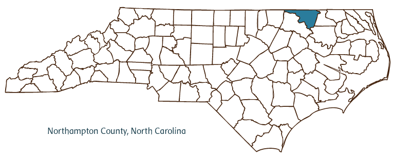
Northampton County, located along the fall line between the Coastal Plain and Piedmont regions of North Carolina, was formed in 1741 from Bertie County and named for James Compton, earl of Northampton. It is bordered in part by the state of Virginia. Early inhabitants of the county were the Tuscarora and Meherrin Indians, followed by Scottish, Scotch-Irish, French Huguenot, and English settlers. The county seat, Jackson, was established in 1742 as Northampton Courthouse; the name was changed in 1823 in honor of U.S. president Andrew Jackson. Other communities in Northampton County include Gaston, Garysburg, Rich Square, Seaboard, Conway, Woodland, Vultare, Severn, Margarettsville, and Milwaukee. Notable physical features of the county include the Roanoke River, Roanoke Rapids, Occoneechee Neck, Taylors Mill Pond, and Gumberry and Panther Swamps.
The Peebles House (nineteenth century), Lee-Grant Farm (ca. 1830), Cedar Grove Quaker Meetinghouse (1868), and Duke-Lawrence House (mid-eighteenth century) are a few of Northampton County's historic attractions. The region hosted an active horse racing scene in the early nineteenth century, which predated that in Kentucky. Sir Archie, a noted thoroughbred, died in 1833 and is buried at Mowfields. Cultural institutions include the Jackson Museum and Northampton Memorial Library. Northampton County also hosts annual events such as the Northampton County Farm Festival June Jubilee.
Important agricultural products of Northampton County include peanuts, soybeans, corn, cotton, broilers, and hogs. Manufactured goods such as chemicals, foodstuffs, farm machinery, lumber and other wood products, and apparel are also produced in the county. In 2004 Northampton County's estimated population was 21,500.
For an annotated history of the county's formation, with the laws affecting the county, boundary lines and changes, and other origin information, visit these references in The Formation of the North Carolina Counties (Corbitt, 2000), available online at North Carolina Digital Collections (note, there may be additional items of interest for the county not listed here):
County formation history: https://digital.ncdcr.gov/Documents/Detail/the-formation-of-the-north-ca...
Index entry for the county: https://digital.ncdcr.gov/Documents/Detail/the-formation-of-the-north-ca...
Additional resources:
Corbitt, David Leroy. 2000. The formation of the North Carolina counties, 1663-1943. https://digital.ncdcr.gov/Documents/Detail/the-formation-of-the-north-carolina-counties-1663-1943/3692099?item=4553233 (accessed June 20, 2017).
Northampton County Government: http://www.northamptonnc.com/
Northampton County Chamber of Commerce: https://northamptonchamber.org/
DigitalNC, Northampton County: https://www.digitalnc.org/counties/northampton-county/
North Carolina Digital Collections (explore by place, time period, format): https://digital.ncdcr.gov
Image credits:
Rudersdorf, Amy. 2010. "NC County Maps." Government & Heritage Library, State Library of North Carolina.
Mazzocchi, Jay. "Northampton County." NCpedia. State Library of NC. 2006. https://www.ncpedia.org/geography/northampton.