Camden County Resources
- View All:
- Biographies
- Monuments
- locations
ANCHOR (A North Carolina History Online Resource) will soon have its own website!
We are setting up redirects so links to current ANCHOR pages on NCpedia will send users to the new site in the future.
Copyright Notice: This article is from the Encyclopedia of North Carolina edited by William S. Powell. Copyright © 2006 by the University of North Carolina Press. Used by permission of the publisher. For personal use and not for further distribution. Please submit permission requests for other use directly to the publisher.

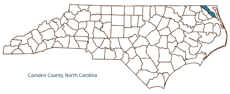
Camden County, located in the Coastal Plain region of northeastern North Carolina and bordered in part by the state of Virginia and Albemarle Sound, was formed in 1777 from Pasquotank County and named for Sir Charles Pratt, earl of Camden, in gratitude for the support he gave to the colonists. The Tuscarora and Weapemeoc Indians, who left North Carolina in 1774, were the first inhabitants of the area; by 1650 English settlers had arrived, many drifting south from Virginia. The county seat, Camden, dates to 1740, when it was known as Plank Bridge. Its name was changed to Jonesborough in 1792 and, by 1840, to Camden. Other Camden County communities include South Mills, Belcross, and Shiloh.
The Great Dismal Swamp National Wildlife Refuge covers parts of Camden County, and farmland makes up 33 percent of the total acreage of the county. Important agricultural products are corn, potatoes, wheat, swine, soybeans, oats, barley, chickens, cotton, and beef cattle. Because the Camden County terrain features a great amount of water, North Carolinians and others travel there for boating, fishing, swimming, and waterfowl observance. The large wild turkey population also attracts hunters.
Historic sites in Camden County include the county courthouse (1847); Sanderlin-Prichard House (1851); Milford (1744-46), North Carolina's oldest remaining two-story brick house; and Shiloh Baptist Church (1729), the state's oldest Baptist church. In 2004 Camden County's population was estimated to be 8,500.
For an annotated history of the county's formation, with the laws affecting the county, boundary lines and changes, and other origin information, visit these references in The Formation of the North Carolina Counties (Corbitt, 2000), available online at North Carolina Digital Collections (note, there may be additional items of interest for the county not listed here):
County formation history: https://digital.ncdcr.gov/Documents/Detail/the-formation-of-the-north-ca...
Index entry for the county: https://digital.ncdcr.gov/Documents/Detail/the-formation-of-the-north-ca...
Additional resources:
Corbitt, David Leroy. 2000. The formation of the North Carolina counties, 1663-1943. https://digital.ncdcr.gov/Documents/Detail/the-formation-of-the-north-carolina-counties-1663-1943/3692099?item=4553233 (accessed June 20, 2017).
Camden County Government: https://www.camdencountync.gov/
DigitalNC, Camden County: https://www.digitalnc.org/counties/camden-county/
North Carolina Digital Collections (explore by place, time period, format): https://digital.ncdcr.gov
Image credits:
Rudersdorf, Amy. 2010. "NC County Maps." Government & Heritage Library, State Library of North Carolina.
Mazzocchi, Jay. "Camden County." NCpedia. State Library of NC. 2006. https://www.ncpedia.org/geography/camden.