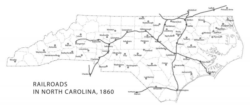
Railroads in North Carolina, 1860
A map of the railroads of North Carolina as they were in 1860. Counties are drawn with present-day boundaries for reference.
See a map of the railroads in North Carolina as they were less than 40 years later, in 1896, here: https://www.ncpedia.org/media/map/railroads-north-carolina

Read the related article:
Usage Statement:
Creative Commons BY-NC-SA
This item has a Creative Commons license for re-use. This Creative Commons BY-NC-SA license means that you may use, remix, tweak, and build upon the work for non-commerical purposes as long as you credit the original creator and as long as you license your new creation using the same license. For more information about Creative Commons licensing and a link to the license, see full details at https://creativecommons.org/licenses/by-nc-sa/4.0/.