Polk County Resources
- View All:
- Biographies
- Monuments
- locations
ANCHOR (A North Carolina History Online Resource) is now its own website!
Copyright Notice: This article is from the Encyclopedia of North Carolina edited by William S. Powell. Copyright © 2006 by the University of North Carolina Press. Used by permission of the publisher. For personal use and not for further distribution. Please submit permission requests for other use directly to the publisher.
See also: Isothermal Belt
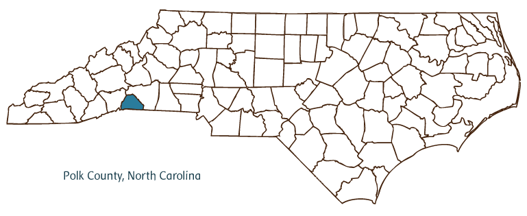
Polk County, located in the Mountain region of western North Carolina, was formed in 1855 from Henderson and Rutherford Counties and was named for Revolutionary War colonel William Polk. It is partially bordered by the state of South Carolina. Cherokee Indians originally inhabited the area, followed by Scotch-Irish and German settlers. The county seat, Columbus, was incorporated in 1857 and named for Columbus Mills, a member of the General Assembly who was instrumental in the county's formation. Other Polk County communities include Tryon, Saluda, and Mill Spring. Notable among physical features of the county are the Green River, White Oak, Panther, and Walnut Creeks, Tryon Mountain, White Oak Mountain, and Brushy Mountain.
Polk County has unusually temperate weather due to its location in the "thermal belt," a southern slope of the Blue Ridge Mountains, making it a popular tourist and retirement destination. County landmarks and historic sites include the Green River Plantation, established in the early 1800s, and the Mills-Screven Plantation, established ca. 1820. The Saluda Grade, the steepest standard-gauge, mainline rail line in the nation, opened in 1878 in the county. Cultural institutions include the Polk County Historical Museum, the Polk County Community Arts Council, and the Tryon Little Theater. Polk County farms produce corn, hay, soybeans, apples, and peaches, and the county's manufactured products include synthetic fibers, yarns, knits, crafts, glass, golf carts, and diamond dies. Minerals such as epidote and hornblende crystals are mined in the county. The estimated population of Polk County was 19,000 in 2004.
For an annotated history of the county's formation, with the laws affecting the county, boundary lines and changes, and other origin information, visit these references in The Formation of the North Carolina Counties (Corbitt, 2000), available online at North Carolina Digital Collections (note, there may be additional items of interest for the county not listed here):
County formation history: https://digital.ncdcr.gov/Documents/Detail/the-formation-of-the-north-ca...
Index entry for the county: https://digital.ncdcr.gov/Documents/Detail/the-formation-of-the-north-ca...
Additional resources:
Corbitt, David Leroy. The Formation of the North Carolina Counties, 1663-1943. Raleigh: Division of Archives and History, North Carolina Department of Cultural Resources, 1987. https://digital.ncdcr.gov/Documents/Detail/the-formation-of-the-north-carolina-counties-1663-1943/3692099?item=4553233 (accessed June 20, 2017).
Polk County Government. "Polk County, North Carolina." https://www.polknc.gov/ (accessed February 15, 2019).
Carolina Foothills Chamber of Commerce. "Carolina Foothills Chamber of Commerce." https://carolinafoothillschamber.com/ (accessed Feburary 15, 2019).
DigitalNC. "Polk County." North Carolina Digital Heritage Center. https://www.digitalnc.org/counties/polk-county/ (accessed Feburary 15, 2019).
North Carolina Digital Collections. "Explore by ... [place, time period, format]." North Carolina Department of Natural and Cultural Resources. https://digital.ncdcr.gov (accessed February 15, 2019).
Image credits:
Rudersdorf, Amy. "NC County Maps." Raleigh: Government & Heritage Library, State Library of North Carolina, 2010.
Mazzocchi, Jay. "Polk County." NCpedia. Library of NC. 2006.

POLK COUNTY GOVERNMENT:
www.polknc.org
COUNTY SEAT: Columbus
FORMED: 1855
FORMED FROM: Rutherford, Henderson
LAND AREA: 237.79 square miles
2020 POPULATION ESTIMATE: 29,328
White: 92.8%
Black/African American: 4.2%
American Indian: 0.6%
Asian: 0.8%
Pacific Islander: <0.1%
Two or more races: 1.5%
Hispanic/Latino: 5.9% (of any race)
From State & County QuickFacts, US Census Bureau, 2020.
CONGRESSIONAL DISTRICT: 10TH
BIOGRAPHIES FOR![]()
Polk County
 WILDLIFE PROFILES FOR
Mountain region
GEOGRAPHIC INFORMATION
REGION: Mountain, though technically some areas are in the Piedmont
RIVER BASIN: Broad, Map
NEIGHBORING COUNTIES: Henderson, Rutherford


