McDowell County [1]
 [2]
[2]
McDOWELL COUNTY GOVERNMENT:
www.mcdowellgov.com [2]
COUNTY SEAT: Marion
FORMED: 1842
FORMED FROM: Rutherford, Burke
LAND AREA: 440.61 square miles
2020 POPULATION ESTIMATE: 44,578
White: 92.3%
Black/African American: 4.2%
American Indian: 0.8%
Asian: 1.1%
Pacific Islander: 0.1%
Two or more races: 1.5%
Hispanic/Latino: 6.4% (of any race)
From State & County QuickFacts, US Census Bureau, 2020. [3]
CONGRESSIONAL DISTRICT: 11TH
BIOGRAPHIES FOR![]() [4]
[4]
McDowell County [4]
 [5]WILDLIFE PROFILES FOR
Mountain region [5]
GEOGRAPHIC INFORMATION
REGION: Mountain [6]
RIVER BASIN: Broad [7], Catawba [8], Map [9]
NEIGHBORING COUNTIES: Avery [10], Buncombe [11], Burke [12], Mitchell [13], Rutherford [14], Yancey [15]
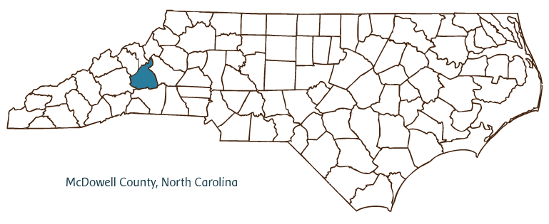
McDowell County, located in North Carolina's Mountain [6] region, was formed from Rutherford [14] and Burke [12] Counties in 1842 and took its name from Revolutionary War colonel Joseph McDowell [17]. The county seat of Marion [18] (incorporated in 1844) was named for Gen. Francis Marion, the "Swamp Fox" of the Revolution; other communities include Old Fort, Ashford, Little Switzerland, Nebo, Pleasant Gardens, Glenwood, Woodlawn, Dysartville, and Sugar Hill.
Originally Cherokee [19] and Catawba [20] Indian territory, the land later organized as McDowell County was settled in the eighteenth century by Scotch-Irish immigrants [21]. To protect the settlers, a series of forts was constructed along the frontier, and it became known as the "Gateway to the Mountains" for westward-bound pioneers. Although its deposits of gold helped North Carolina become, in the early nineteenth century, the nation's leading gold producer, McDowell County has been largely untouched by urban development. Roughly 75 percent of the county remains forested and boasts a wide array of wildlife, waterfalls, and scenic vistas. One of the Mountain region's most well-known natural attractions, the spectacular Linville Caverns [22], lies beneath the McDowell County-Avery County [10] line. The town of Old Fort is also home to Mountain Gateway Museum [23] and the Arrowhead Monument, a 15-foot-tall arrowhead carved from pink granite in the 1930s as a tribute to the county's original Native American inhabitants. Andrews Geyser [24], west of Old Fort, was built in 1885 as a unique attraction for railway patrons. Carson House [25], a home dating to the late eighteenth century, served as a courthouse and home to a prominent local family. McDowell County produces many goods, including Christmas trees, livestock, textiles, furniture, and pharmaceuticals. The population of the county was estimated to be just over 43,000 in 2004.
Annotated history of McDowell County's formation:
For an annotated history of the county's formation, with the laws affecting the county, boundary lines and changes, and other origin information, visit these references in The Formation of the North Carolina Counties (Corbitt, 2000), available online at North Carolina Digital Collections (note, there may be additional items of interest for the county not listed here):
County formation history: https://digital.ncdcr.gov/Documents/Detail/the-formation-of-the-north-ca... [26]
Index entry for the county: https://digital.ncdcr.gov/Documents/Detail/the-formation-of-the-north-ca... [27]
References:
Mildred B. Fossett, History of McDowell County (1976).
Additional resources:
Corbitt, David Leroy. 2000. The formation of the North Carolina counties, 1663-1943. https://digital.ncdcr.gov/Documents/Detail/the-formation-of-the-north-carolina-counties-1663-1943/3692099?item=4553233 [28] (accessed June 20, 2017).
McDowell County Government: https://www.mcdowellgov.com/ [2]
McDowell County Chamber of Commerce: https://www.mcdowellchamber.com/ [29]
McDowell/Blue Ridge Tourism. https://www.blueridgetraveler.com/ [30]
DigitalNC, McDowell County: https://www.digitalnc.org/counties/mcdowell-county/ [31]
North Carolina Digital Collections (explore by place, time period, format): https://digital.ncdcr.gov [32]
Image credits:
Rudersdorf, Amy. 2010. "NC County Maps." Government & Heritage Library, State Library of North Carolina.
1 January 2006 | Vocci, Robert Blair