Copyright notice

This article is from the Encyclopedia of North Carolina edited by William S. Powell. Copyright © 2006 by the University of North Carolina Press. Used by permission of the publisher. For personal use and not for further distribution. Please submit permission requests for other use directly to the publisher.

Printer-friendly page

Post Roads

by Robert J. Stets, 2006

Map of Wilmington drawn by Hugh Finlay, surveyor of the post roads, January 17, 1774. Image from Archive.org. Post roads were routes created to facilitate correspondence between America's European settlers and their home countries. The earliest record of an attempt to set up a post road in North Carolina is a letter written by William Farris, dated 27 Jan. 1739. Farris, who identified himself as "postmaster of North Carolina," petitioned the South Carolina Common House of Assembly to contribute money to establish a post road from Georgetown to Eden Town, "from whence they have a regular Post once a month to Virginia." This post was established, as records indicate that Farris was paid £200 for his services-although the post apparently was short-lived, as no appropriation was made after the first year. In October 1755 a message was read during a session of the North Carolina legislature clearly stating that "there is no established post thru this Province."Map of North and South Carolina, showing Post Roads and mileage, 1828. Image from NC Maps.

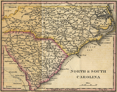
Until 1792 post roads through North Carolina, such as they were, served only a few coastal towns; anyone who lived in the interior had to depend on travelers or private mail carriers to carry their letters to and from the coastal post offices. In 1792 Congress authorized a change in the location of the main post road, moving it back to pass through Halifax, Tarboro, Smithfield, Fayetteville, and Lumberton, with cross posts to the coastal offices. In 1794 the main north-south post road was moved even farther inland, so that it passed through Warrenton, Louisburg, the new state capital at Raleigh, Averasboro, and Fayetteville. By 1795 cross posts had been established for all but the most westerly counties, and by 1801 an extensive network of post roads stretched across the entire state.

Additional Resources:

"Early Trails, Trading Paths; State Breaks Traffic Limits." The E.S.C. Quarterly 11. No. 3-4. Summer-Fall 1953. p. 70-72. https://digital.ncdcr.gov/Documents/Detail/e.s.c.-quarterly-1953-summer-fall-v.11-no.3-4/4239199 (accessed October 12, 2012).

Stroupe, Vernon S. "Postal History - The Basics." Final Report of the North Carolina Postal History Commission. North Carolina Postal History Commission. 2000. http://exhibits.archives.ncdcr.gov/postal/postal_history_basics.pdf  (accessed November 1, 2013).

Finlay, Hugh. Journal kept by Hugh Finlay, Surveyor of the Post Roads on the Continent of North America, during his survey of the post offices between Falmouth and Casco Bay in the Province of Massachusetts, and Savannah in Georgia begun the 13th Septr. 1773 and ended 26th June 1774. Brooklyn [N.Y.]: Frank H. Norton. 1867. https://archive.org/stream/journalkeptbyhug00finl#page/66/mode/2up (accessed October 12, 2012).

Image Credits:

Finlay, Hugh. "From this Tavern we see the town of Wilmington at the end of an avenue cut through an island, two miles across; this island is in Cape Fear River, and lyes in the manner here described." Map. Journal kept by Hugh Finlay, Surveyor of the Post Roads on the Continent of North America, during his survey of the post offices between Falmouth and Casco Bay in the Province of Massachusetts, and Savannah in Georgia begun the 13th Septr. 1773 and ended 26th June 1774. Brooklyn [N.Y.] Frank H. Norton. 1867. 66. https://archive.org/stream/journalkeptbyhug00finl#page/66/mode/2up (accessed October 12, 2012).

Darby, William. "North & South Carolina." Map. 1828. http://dc.lib.unc.edu/cdm/singleitem/collection/ncmaps/id/172/rec/2